
What the heck is a road diet?!
Just as the name implies, a “road diet” (a.k.a. lane reduction, lane repurposing, road conversion) is where the number and/or width of vehicle lanes is reduced, often to achieve a reduction in speed and crash rates.
The most common road diet is to convert an undivided road with four vehicle lanes into a road with three vehicle lanes (two through-lanes and a centre two-way left-turn lane).The freed-up space is used for pedestrians (sidewalks, refuge islands), cyclists, public transit, parking, or landscaping. A number of designs are possible.
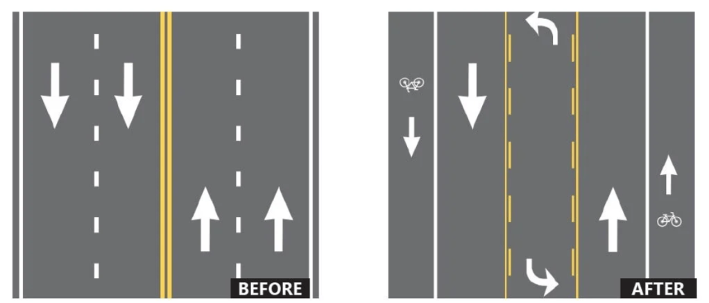
Source: Living Streets Alliance
Doesn’t reducing the number and/or width of vehicle lanes make traffic worse?
Perhaps counterintuitively, many road diet projects have not resulted in significant increases in traffic congestion on the converted road or nearby roads. This has been the case in Davis, California, Los Angeles, San Jose, and Minnesota, among others.
How could that be? You may have heard that increasing the number of lanes on a highway often has the seemingly paradoxical effect of increasing overall vehicle travel. This phenomenon is known as induced demand to use roadways: for every 1% increase in highway capacity, there is 1% more driving on those highways.
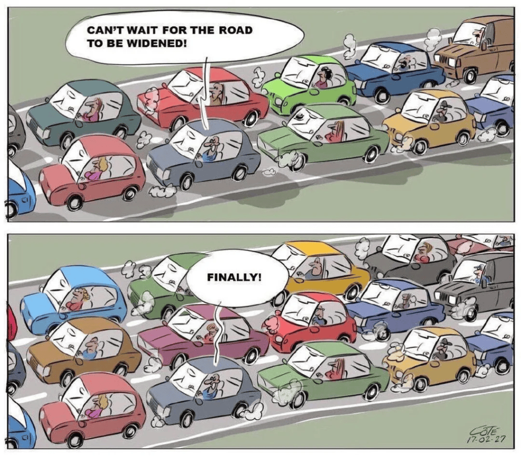
On the flipside, reducing road capacity can actually reduce demand. Take one example in Santa Monica, where a road diet resulted in a traffic volume decrease of 13% to 19%, while traffic volumes on nearby streets remained relatively stable, and speeds and collisions decreased by 27% and 65%, respectively.
Why might the decrease in traffic volumes due to a road-diet in one area not result in a corresponding increase elsewhere? One explanation is that fewer cars and lower speeds make the road safer to walk and cycle instead of drive, especially if bike lanes or sidewalks replace vehicle lanes. Similarly, if vehicle lanes are repurposed for bus-only traffic, more people may take transit instead of drive.
What are the benefits of road-diets?
Some of the benefits of road-diets have been alluded to above, and include those listed below:
- Reduction of crashes by 19 to 47% ( fewer conflict points, less volume, lower speeds)
- Fewer delays when turning lanes are created
- Less stop-and-go traffic due to vehicles going more similar speeds
- Improved pedestrian and bicycle accessibility and safety (bike lanes, sidewalks, refuge islands, less lanes to cross)
- More room for public transit (transit-only lanes, pullover areas)
As well, road-diets can cut greenhouse gas emissions by reducing overall vehicle distance travelled and encouraging walking, cycling and transit.
How can road-diets be effectively implemented?
Road diets are not a one-size-fits-all solution to be applied to every section of road. A variety of data are needed to identify good candidate locations, such as collisions, volume, speeds and more.
Designing a road diet requires considering many factors, including the features discussed above, regulations, traffic signals and timing, and others.
Equally important is evaluating a road diet after completion. It’s vital to do a comparison of pre- and post-installation data.
Throughout the process, public consultation and education is crucial to the success of a road diet. Some jurisdictions have even done road-diet trials, guaranteeing to return the road to its previous configuration if the community requests it (a rare event), which increases buy-in and trust.
Where have road diets been implemented across the Lower Mainland?
Several municipalities have already done impressive road diets in the Lower Mainland. In Downtown Vancouver, Richards, Smithe, Hornby, and Dunsmuir have all seen vehicle lanes reduced to make room for protected bike lanes.
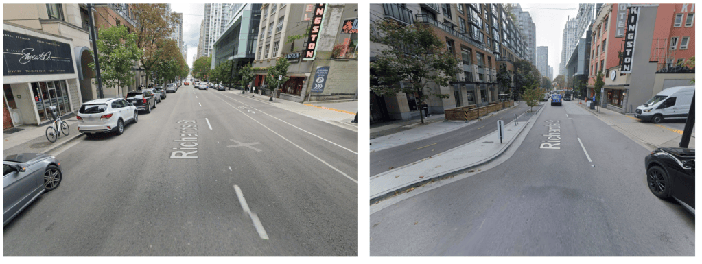
Richards St was reduced from 4 total lanes to 2, to make room for a protected 2-way bike lane, wider sidewalks, and patios. Photo credit: Google street view
Recently, the Granville Bridge has gone from 8 vehicle lanes to 6, to make more space for people walking and biking.
In New Westminster, both Columbia St and 6th St, two of the main commercial streets in the city, have been reduced in width. In North Van, Esplanade didn’t lose any vehicle lanes but all lanes were narrowed, to make room for new protected bike lanes and to encourage slower vehicle traffic.
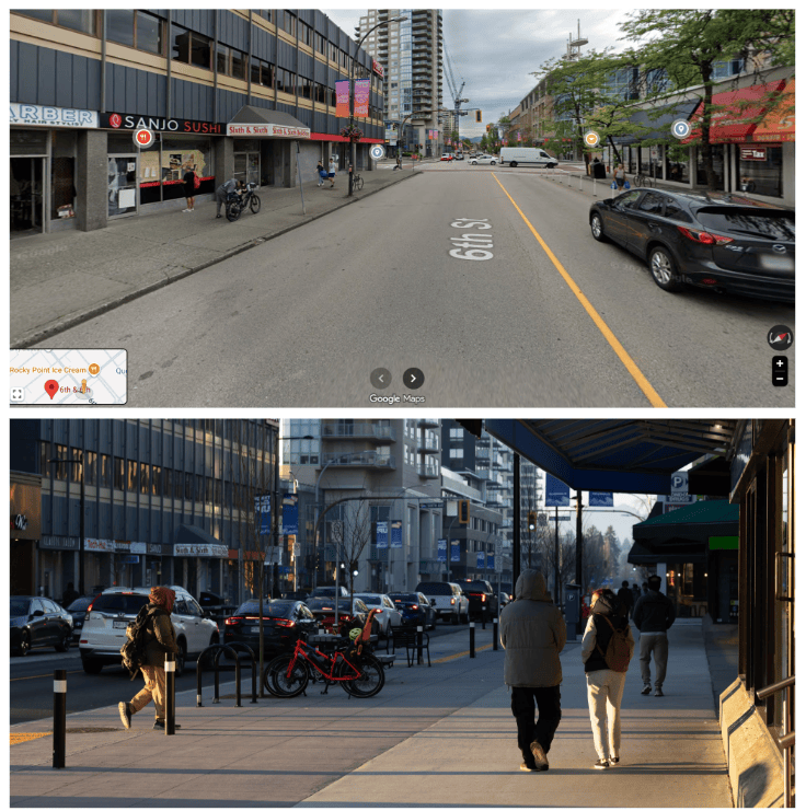
6th St in New West, before and after. The vehicle lanes were narrowed, and some parking removed, to make room for much wider and bollard-protected sidewalks. Photo credit: Google streetview (top), Michael Hall (bottom).
And where do we want to see more?
There are countless additional streets that could benefit from road diets, including:
Broadway: the soon-to-open subway will take tens of thousands of vehicles off the street, and there’s no need for Broadway to be 6 lanes anymore. A reduction to 4 lanes will allow for new protected active transport lanes. More on this soon!
East Hastings: this street sees the highest rate of pedestrians hit by drivers in the entire Lower Mainland. The sidewalks are far too narrow. A reduction from 6 lanes to 5 (2 in each direction plus a turning lane, or 2 in each direction plus parking on one side only) will allow for a significant sidewalk expansion.
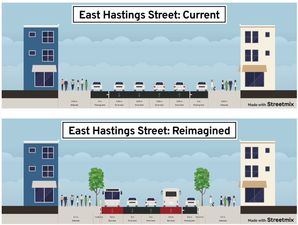
Our concept for a E Hastings re-design.
Kingsway: This wide road holds a ton of cool shops and businesses, but is very hostile to anyone outside a car. Expanded sidewalks would bring more foot traffic to the businesses, and the diagonal orientation that lets you cut through the city makes it a great option to install protected bike lanes.
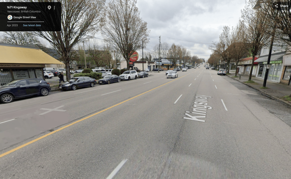
Kingsway has so much potential, if we didn’t give up all the space to cars.
How can you help?
Contact your municipal government and encourage them to explore road diets in your community:
Port Coquitlam – Mayor – Council
— Written by Rob Brownridge

