Interactive Traffic Violence Tracking Map
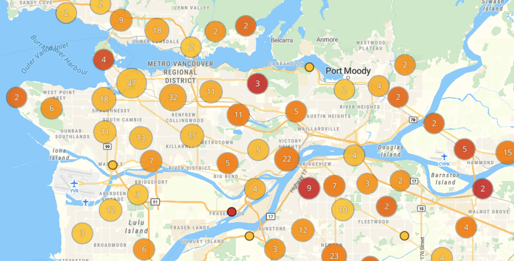
Our interactive crash map plots independently recovered vehicle crashes resulting in serious injury or death from January 2023 onwards.
It gives information on severity (injured/killed), travel mode (driver, pedestrian, etc.), and it includes links to a news story where possible. On your phone? The map is optimized for a computer and you may run into a few formatting hiccups while we make updates (March 2026).
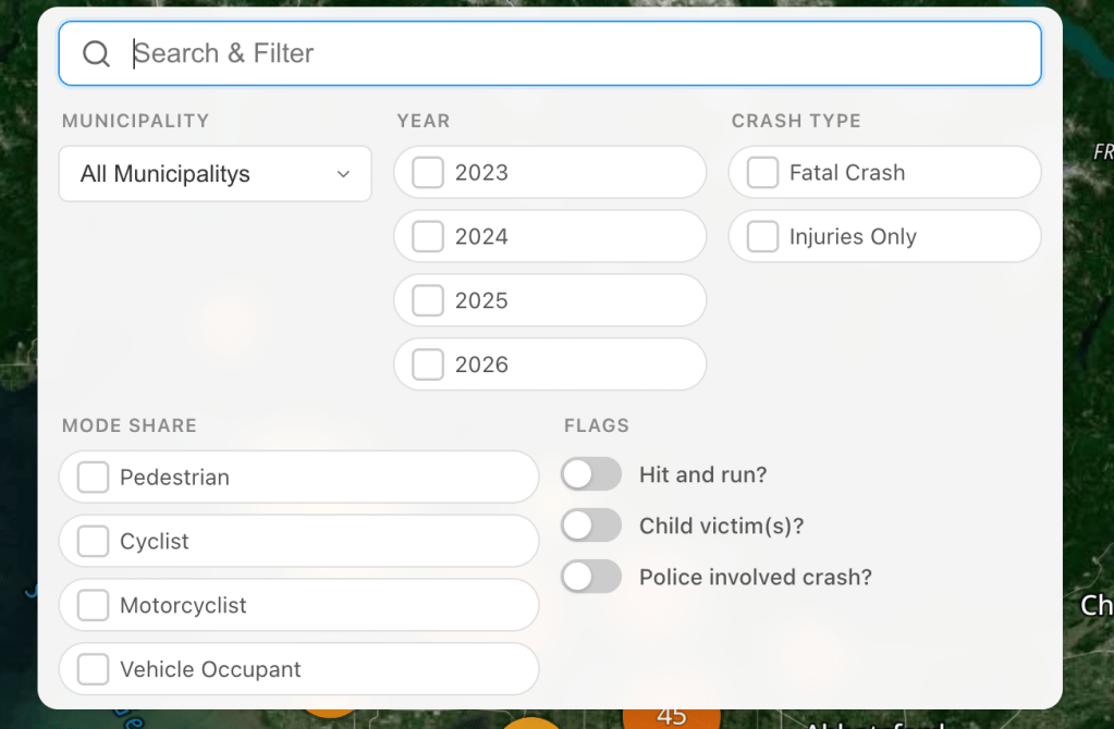
New as of March 2026: crashes can now be filtered by year, mode share, severity, and other factors:
Do you know of a serious crash that we missed? Please email us the details at contact@visionzerovancouver.ca and we will add it to the map.
